The Whitney Trail
Hannah Fleming
There are some things that have always been on my bucket list: traveling to Europe, making it to each of the 50 states, sky-diving, and swimming with dolphins. And then there are the things that are added to the bucket list as SOON as you hear about them, Mt. Whitney is one of those.
Nestled in the Sierra Nevada mountain range, Mt. Whitney is the tallest mountain in the continental U.S. It's highest peak reaches 14,505 feet above sea level.
Preparation

Permit- A permit is required to hike in the Mt. Whitney Zone in the John Muir Wilderness. Details regarding how to obtain a permit can be found here.
Health - When hiking in high altitude, with huge elevation gains, physical fitness is important. We train by running 2-3 miles, 5-6 times a week, lifting weights a few times a week, and doing training hikes in as high of altitude as we can. Checkout my hiking page for details on those hikes! In addition to being in good physical condition, we fuel our bodies with healthy food, and make sure to take plenty of rest days! We also decided to take medicine to help us adjust with the altitude. This is a doctor prescribed medication.
Gear
Bag - 65L Osprey Aura
Tent- Marmot 3 Person
Sleeping Bag- Marmot Trestles 15 Sleeping Bag
Sleeping Pad- REI Camp Bed 2.5
Fire- MSR PocetRocket
Water Purifier- SteriPen
Bear Canister - Rented from REI
Clothes- spandex shorts, leggings, hiking pants, long sleeve, short sleeve, tank top, down jacket, hat, gloves, mittens, and an extra pair of socks
Food- bagels, Clif bars, peanut butter, pre-packaged camp food, dried fruit, trail mix.
A great resource we referenced was the Whitney Trial Conditions thread. It gave us some great insight into what the trail conditions were actually going to be like, especially since there was more snow coverage this year than normal!
Day 1: Sleeping at 4,000
To ensure our bodies had plenty of time to adjust, we spent Thursday night Lone Pine. We got a great night’s rest before two nights of camping.
Day 2: Sleeping at 8,000
Friday morning we picked up our permit, took our last showers for 48 hours, and headed up Whitney Portal Road. We spent the afternoon lounging by the river and re-packing our bags while our bodies adjusted to the altitude. Whitney Portal Campground has restrooms, a store (with a restaurant!), and most importantly - is located at the head of the The Whitney Trail.
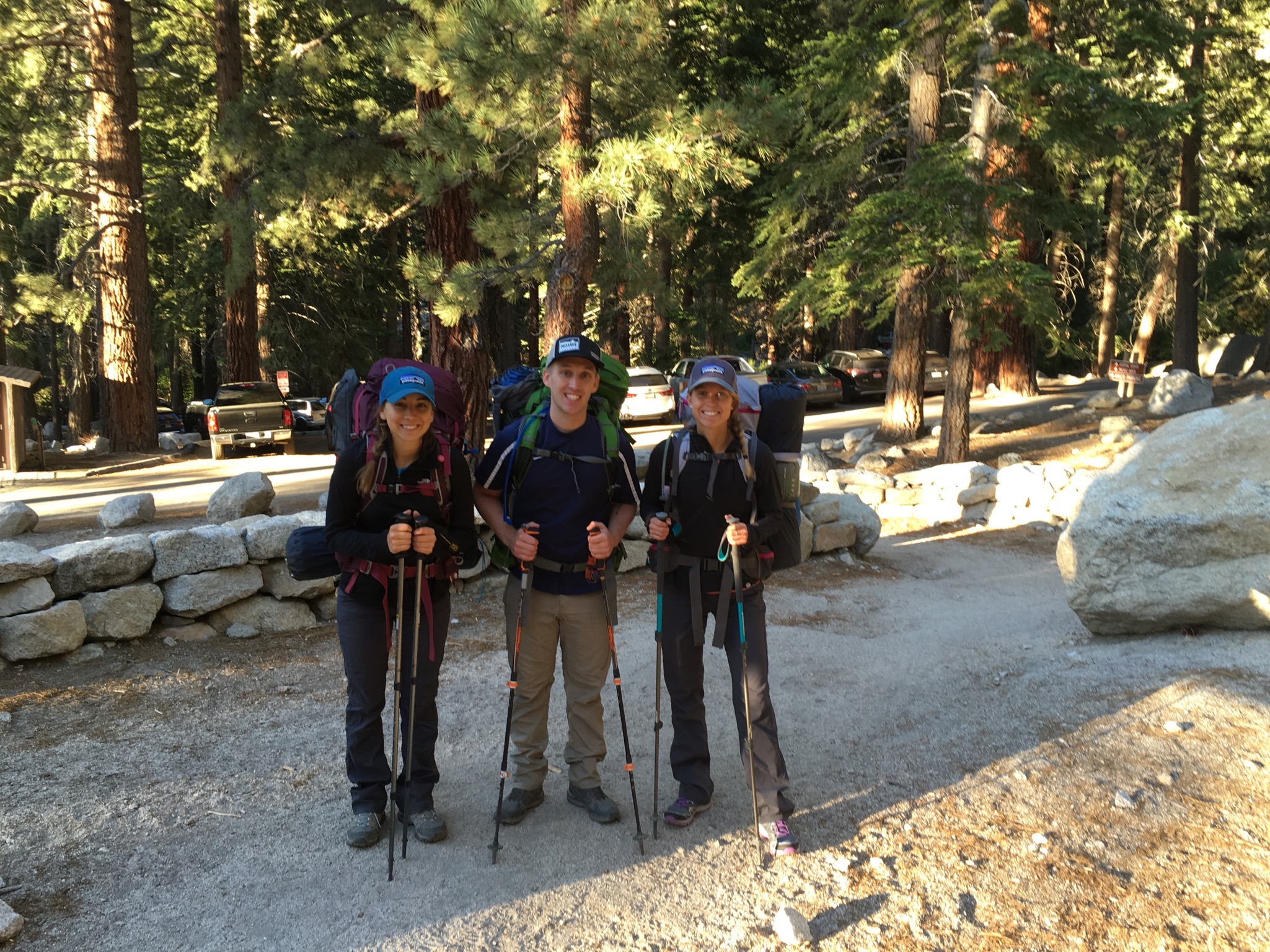
Day 3: Making it to Trail Camp
Saturday morning we packed up our tent, sleeping pads and packs, made oatmeal, and hit the trail at 6:30 AM. We weighed our bags at the weigh station at the head of the trail, and were surprised that they weighed between 35-40 pounds. This is when I decided I need to invest in lightweight backcountry equipment. Nevertheless, we began our slow and steady journey to trail camp. We made sure to take frequent rests for water, and a 5-10 minute break every hour to grab some fuel (Clif bar chews, part of a granola bar, or some dried fruit). Time was in our favor, and we had all day to make it the 6 miles to trail camp.
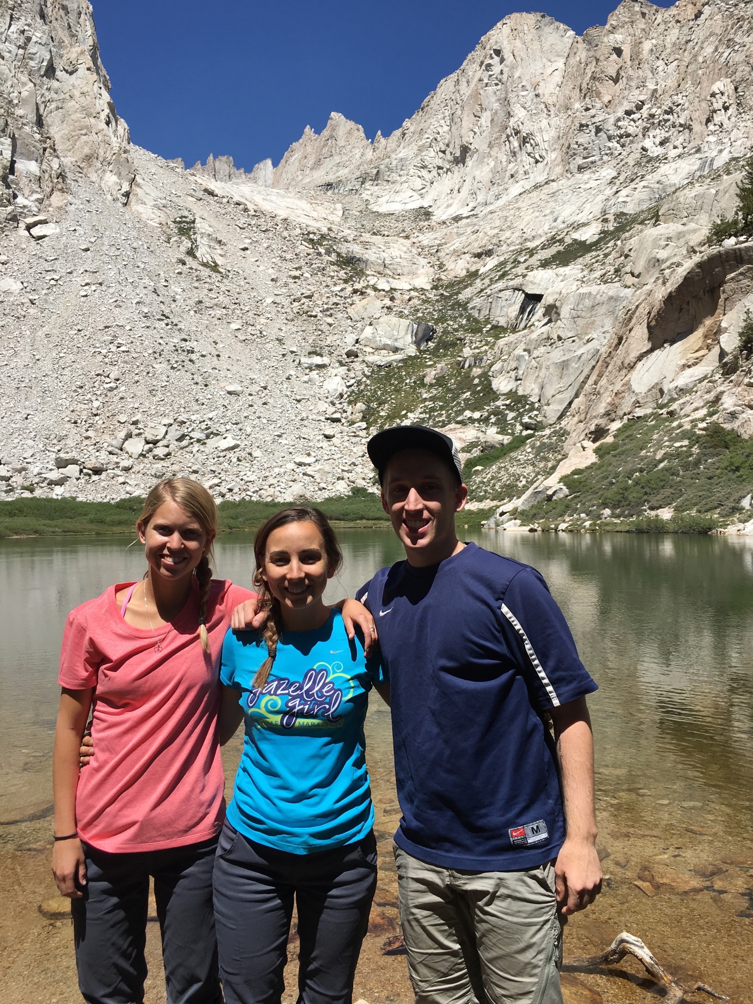


I knew within the first mile as our boots were off and we were crossing Lone Pine Stream, this would be one of my favorite trails. It is full of river crossings, lakes, waterfalls, beautiful landscapes, and even a meadow with wildflowers. A hike is always better with beautiful wildflowers.
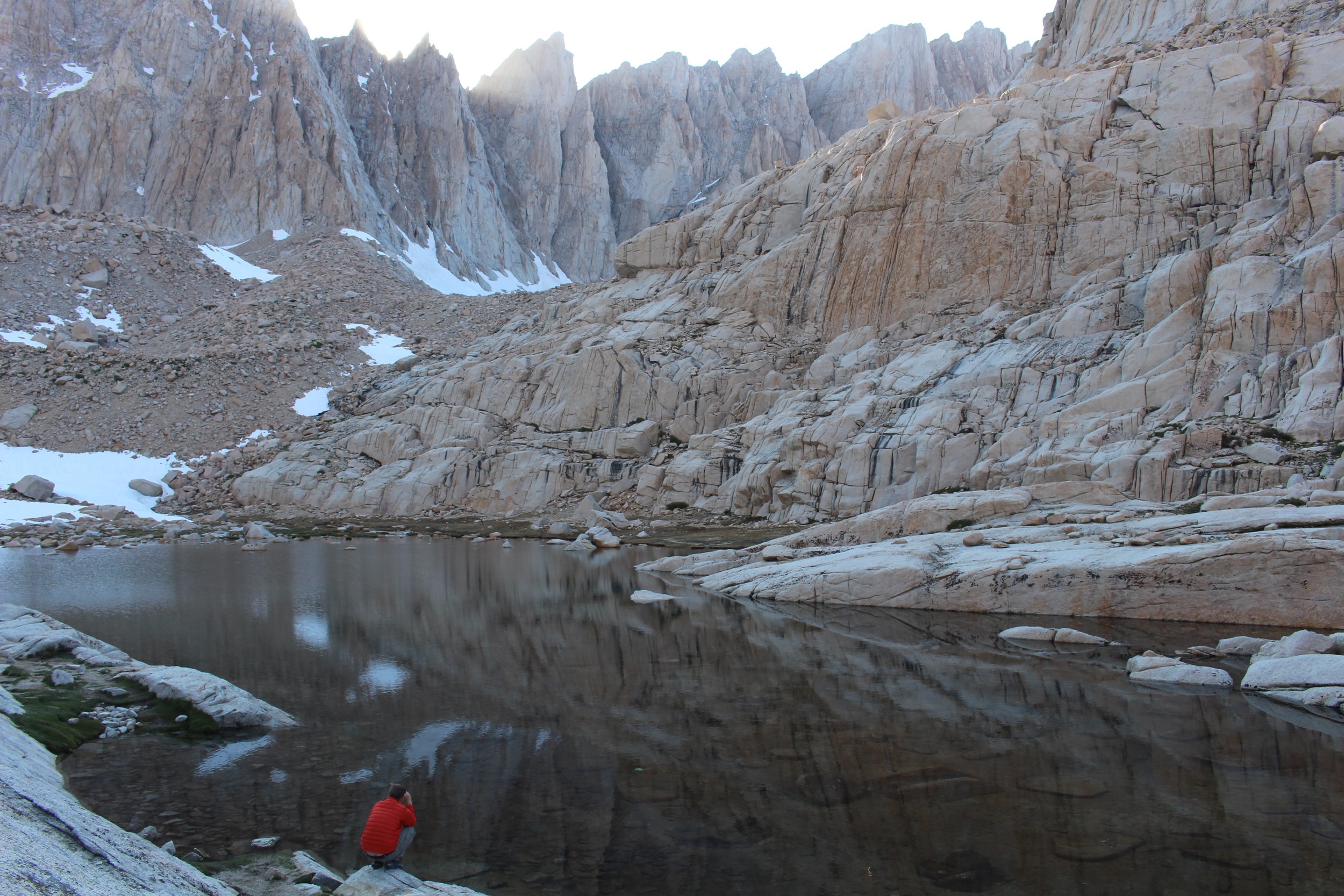
We arrived by 2:30PM at trail camp and immediately ate another snack (so much food!) After setting up camp, resting, and cooking dinner, we prepped our gear for the early morning summit. This was when we thought we would need to prepare tons of water for the next day, but were happy to discover the even more clean water!! We tested the water multiple times with my SteriPen, and were excited as the light flashed green within seconds of dipping it into the water. (Note that along the trail there is plenty of fresh water to fill your bottles, and you don't need to pack as much :) ) We filled our CamelBak's and water bottles with the snowmelt streams flowing into the lake. We brought smaller day packs, and would leave the rest of our gear at Trail Camp.
Day 4: Summit to Sea Level
Sunday morning was go-time. The alarm on my watch went off at 3:15, giving us 45 minutes to grab some food, wake up a bit, and hit the trail. After moving around a bit and trying to eat some breakfast, Hannah started feeling a bit off. But, determined to Summit, we geared up, strapped on our headlamps, and started hiking. About 50 feet down the trail the early signs of Altitude Sickness really began to hit her. We returned to our tent, rested for another hour, drank some electrolyte infused water, and hoped her body just needed a little more time and some daylight to adjust. And we were right!

About a 1/2 mile up the trail from Trail Camp is when you begin the dreaded 99 switchbacks. We approached these the same way we had the rest of the trail, slow and steady, with lots of breaks. The switchbacks make up about half of the remaining 4 miles from Trail Camp to the Summit. The switchbacks are known for being dangerous when there is still snow/ice, so hikers must use the “chute” route up the mountain. However, by the time we were hiked in mid-June the switchbacks were safe and (mostly) clear of snow and ice.
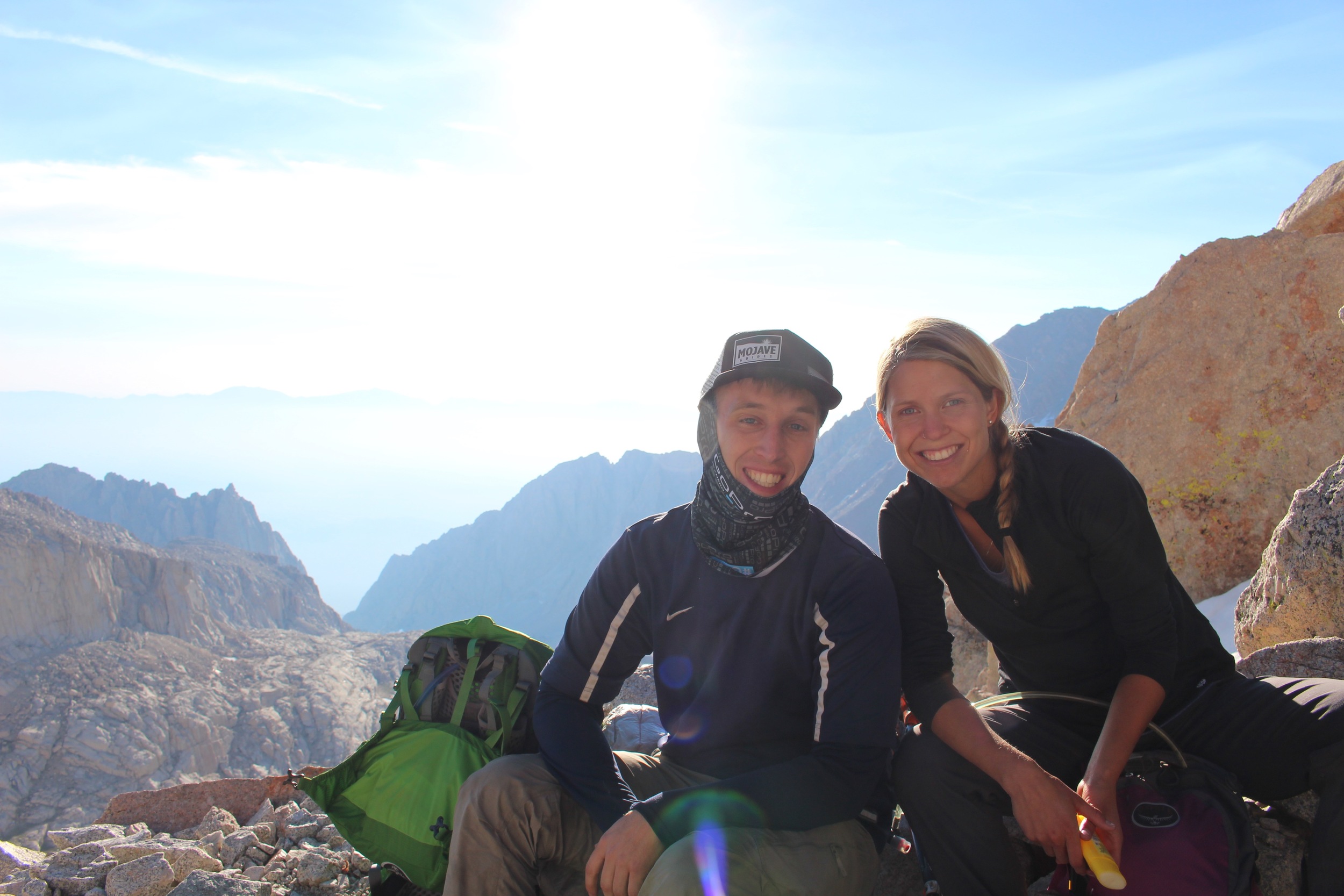
After 2 miles of switchbacks, you’ll reach Trail Crest. This is the point where the trail crosses into Sequoia National Forest, and you’ll meet up with the end of the John Muir Trail coming up the back side of the range. This was one of my favorite parts of the hike. Hearing stories from hikers who had been gone for two weeks is all the motivation you need to hike the remaining miles to the summit!
The final push to the summit was no more challenging than the rest of the trail, besides some careful footing for a 100 yard stretch of snow-covered trail.
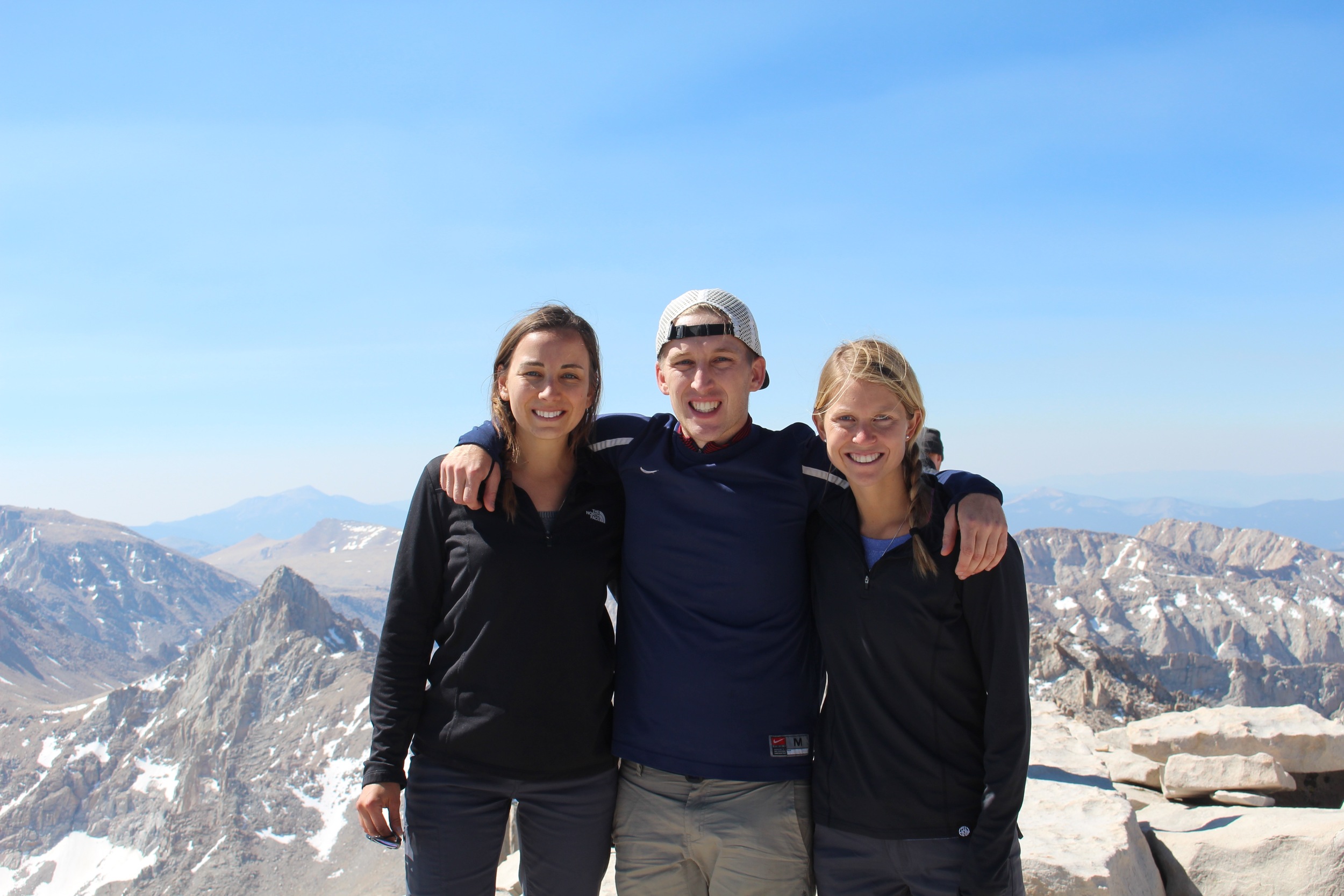
After reaching the summit, taking pictures, and calling our families (there is LTE up there!!!), we began the return journey. We picked up our pace a bit on the way back down, and made it back to our cars by 6PM.

Final Thoughts
This was one of the most mentally and physically challenging experiences of my life, and thus, the most rewarding. I truly encourage everyone to go experience how beautiful our world is!

For a different perspective, and even more details on our hike, head over to hannah's blog!