Stanley, Idaho - Sawtooth National Forest
Hannah Fleming
Growing up in the midwest I had a very distorted, romanticized view of the West. I thought all of the skiing was in Colorado and Utah, and the rest was just farmland or vast nothingness. I was definitely wrong.
Once I moved to Utah, Idaho quickly moved onto my radar and to the top of the list of places to go for winter and summer mountain adventures.
With the 4th of July Holiday falling on Wednesday this year, I took the opportunity to take the rest of the week off and head up to Sawtooth National Forest!
Camping
By the time we decided to go, all sites in the region were booked up. I spent a few hours finding first-come first-serve sites in the Stanley / Galena region, made a list, and hoped we’d get lucky! I used recreation.gov and freecampsites.net.
We left Ogden by 7 AM on Thursday, and headed straight for the first site on my list – Sunny Gulch. Located North of Galena, and just south of Stanley, we would have access to hiking, biking, lakes and rivers.
Rolling into the campground around 1 PM, we had plenty of sites to choose from. We discovered this is the perfect time to look for a site, as the campers from the previous night were heading home, and lots of people wouldn’t arrive until closer to dinner. We chose a shady spot, complete with a nice fire ring, picnic and prep table. The campground runs along the Salmon River, providing a perfect natural ice bath for sore feet after a long day of hiking.
Next time I camp in the region, I’ll try and book a bit sooner and get a spot on the West side of State Road 654B with a better view of the mountain range. But for last minute, this Sunny Gulch was perfect.

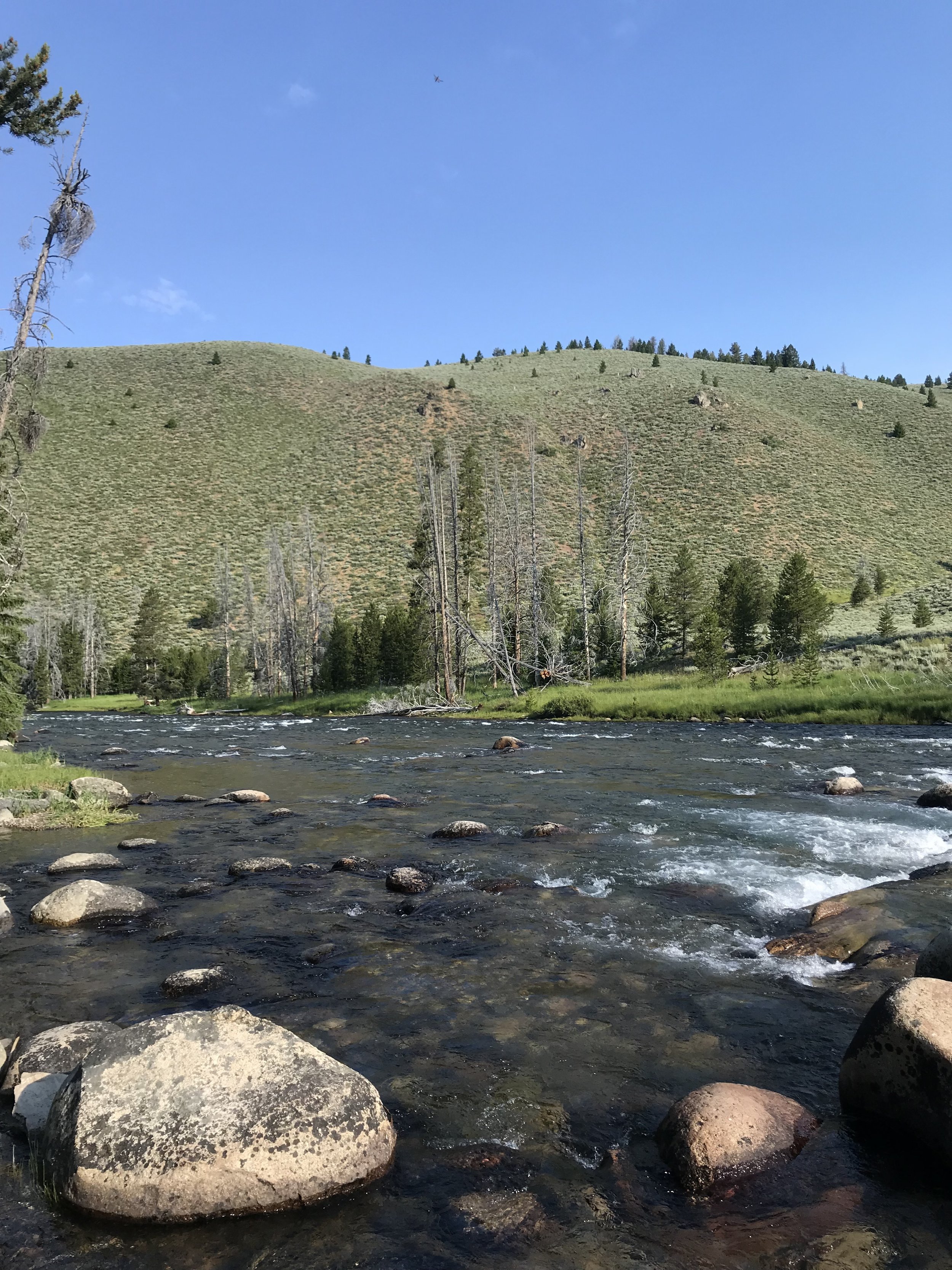
Salmon River
(Hike) Day 1: Redfish Lake Trailhead to Marshall Lake Hike
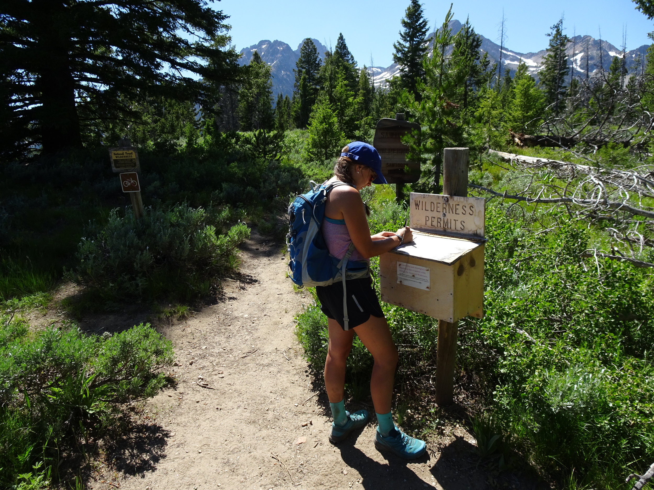
After setting up camp, we made our way to Redfish Lake to go for a hike. Without planning a specific hike (something I don’t normally do), we found the trailhead, packed two water bottles, and started up the trail towards Marshall Lake. The hike would be roughly 10 miles round trip, with over 2200 ft. of elevation gain. Winding away from Redfish Lake, and deeper into the Sawtooths, the trail was beautiful. About one mile out from the Lake, there was a fork in the trail, without any signs pointing to which trail would take us to Marshall Lake (you can see photos of this. This is the first time I can remember hiking without a map, and our we quickly learned our lesson.
We chose the fork to the left – 1. It looked like a more scenic route and 2. It looked steeper, so we were thinking it would be a shortcut. ¾ of a mile later, the trail ended in a valley between two mountains, with Marshal Lake just on the other side of the ridge. We chose to scramble up boulders ½ mile up the ridgeline, hoping we could just scramble down the other side, ending up at the lake. We made it to the top, peered over the other side, saw beautiful Lake Marshall…and knew we would have to return the way we came. It was nearly 90 degrees, both of us were out of water, and all I wanted to do was get back to the trailhead.
Using the breadcrumb feature on our Suunto GPS watches (Suunto 9), we made our way back to the trail, and returned safely to the trailhead.
This was a beautiful hike, but left me with a humbling reminder to respect nature, and to always be prepared. Just like I learned in Girl Scouts :)

The end of the trail, beginning of scrambling

Scrambling

Scrambling

(Ride & SUP) Day 2: Lake Stanley
Determined to make up for yesterday’s mishap, we were determined to go for a great ride, and be fully prepared.

Starting at the Stanley Lake trailhead, the smooth dirt trail takes you through beautiful fields as it makes it’s way into the woods. The “moderate” trail could be classified as “easy” until you reach the first river crossing. Advanced riders can pedal across, I had a good foot-numbing wade across. From here the trail gets a bit more technical, with lots of down trees from recent flooding. A few sections of trail was washed out completely. Despite our best efforts, there was one last river crossing that I was not game for before reaching the top, and for the second day in a row, we did not make it to the destination.
However, with 1500 feet of climbing up, we knew we were in for a fun downhill (outside of a few sections where I had to pick up my bike over trees every 50 feet)!


SUP- Stanley Lake
We ended the day with an awesome paddle board session / took time to rinse off the dirt from the past two days. NOTE: to paddle board in Idaho, you need to pick up an Idaho Invasive Species sticker. You can pick these up at the super market in town. The sheriff in town told us these will soon be available at more of the boating/fishing stores as well.


Cleaning up in the lake using bio-degradable soap
(Ride) Day 3: Galena Lodge
After two peaceful nights of camping, we packed up our things and headed back south towards Utah, stopping along the way at Galena Lodge.
Ride – Galena Lodge
After driving along State HWY 75 in what seems like the middle of nowhere, you turn a corner, and run into Galena Lodge. The Lodge offers great, healthy food options, along with maintaining 40+ miles of awesome trails.
We chose to connect Psycho Ride -> Outhouse Loop -> Gladiator -> RIp & Tear for a 6.5 mile fun loop, complete with lots of climbing, and my first time riding what felt like a roller-coaster of bermy-downhills.

Takeaways for next time:
- Plan a campsite earlier
- Do more research on hikes and rides
- Stay longer!