Contact Hannah


123 Street Avenue, City Town, 99999

(123) 555-6789

email@address.com


You can set your address, phone number, email and site description in the settings tab.
Link to read me page with more information.

Blog

Filtering by Tag: National Park

My first time to Montana! Glacier National Park, Whitefish and Missoula

Hannah Fleming


IMG_3022.JPG

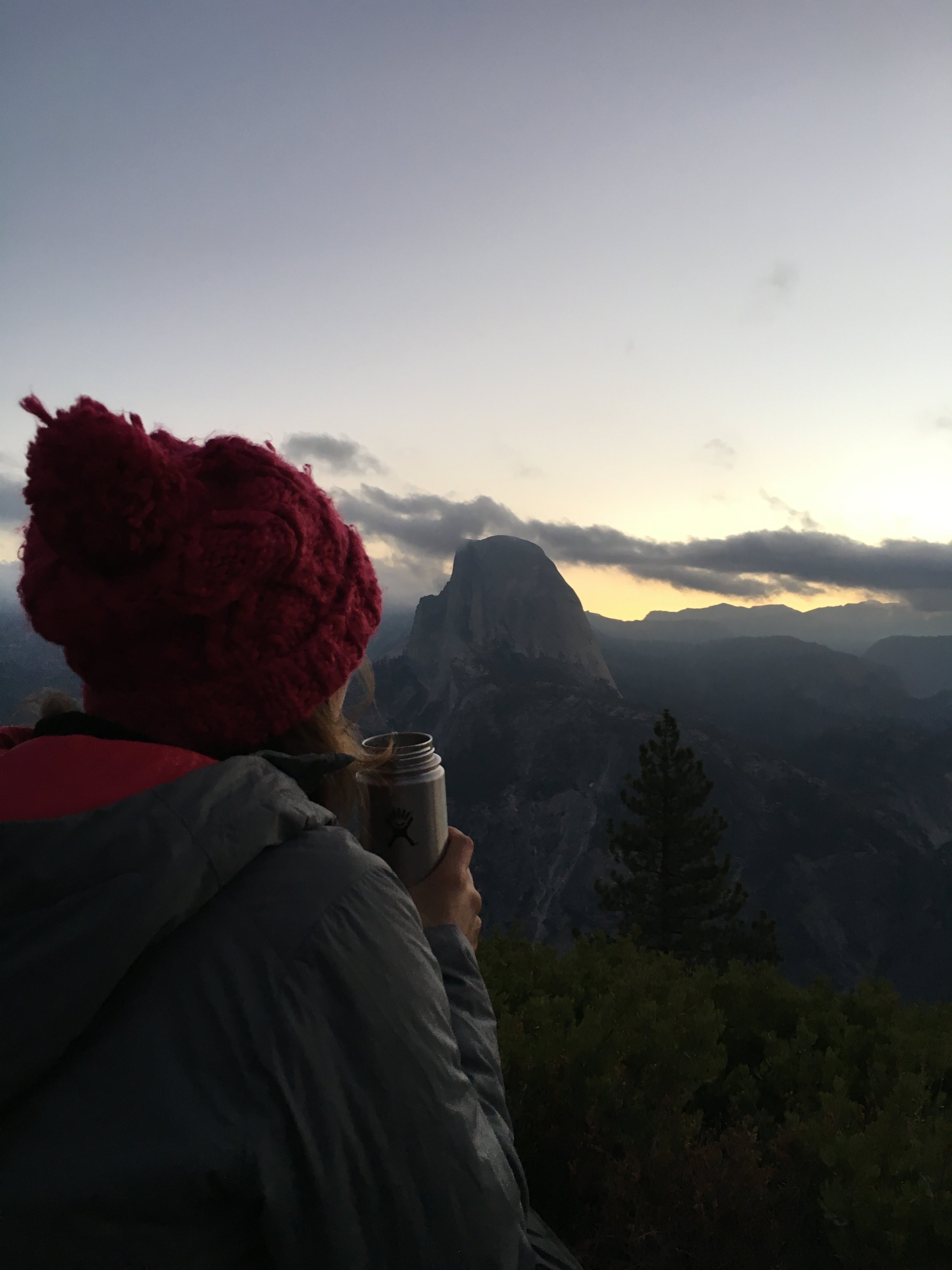
Following Ironman 70.3 Coeur d’Alene, we spent a few days in Montana. We anticipated sore legs, so planned on this being a “get familiar” with Glacier National Park trip, with the expectation of making it back to do some of the bigger hikes. Mother Nature was looking out for our well-being, and even gave us a few “forced rest days” in the form of non-stop rain. Despite the gloomy weather, we made the best of our time in Montana!

Glacier National Park

Camping: We reserved a spot at the KOA in Whitefish just outside of the park, with the intention of getting up early the next morning to get a first-come first-serve spot inside. We had a feeling with the rainy weather, we might get lucky and be able to snag one the first day we arrived, and we did! We stayed at Apgar Campground. It had showers, restrooms, a gift shop, and a few restaurants.  For us, it was convenient how close we were to the visitor center and the park entrance, as we knew we would need some rainy day suggestions! (Pro tip: some National Parks have a campground status website now - here is Yellowstone's)

 What to do (when it’s raining almost the entire time)

  • Going to the Sun Road - With rainy skies and fog hanging low in the valley, there was really only one thing we could do - drive Going to the Sun Road and hope the clouds clear. After stopping at a few overlooks and meandering down a few trails, the clouds begin to clear and we saw the sun for the first time!

  • Logan Pass - At the top of Logan Pass we luckily found a parking spot, after circling for 15-20 minutes. Keep in mind this is a destination in the park, so get there early if you can. We hiked along the Hidden Lake trail, which was still covered with quite a bit of snow. Make sure to always carry sunglasses, even on overcast days. The reflection off the snow was harsh on my unprotected eyes!

  • Lake McDonald – Great sunset spot!

  • Get Ice Cream!

  • Board Games - luckily my Mom taught me to always bring something to do when it rains. Come prepared with a deck of cards, Yahtzee, chess, ConnectFour, whatever your game is, bring it!

@benjamintfleming

@benjamintfleming

Hidden Lake @benjamintfleming

Hidden Lake @benjamintfleming

Lake McDonald

Lake McDonald

@benjamintfleming

@benjamintfleming

Whitefish Mountain Resort (just outside of Glacier)

A few hour break in the rain led us to Whitefish Mountain Resort to get in as many downhill laps as we could. $50 for an all-day pass, with access to 25 miles of trails!

Rattlesnake National Forest - Missoula, MT

With clearer weather south of Glacier, we cut the trip short and headed back to Missoula for some awesome single track in Rattlesnake National Forest! The trails were steep, flowy, and dry!

Overall, This trip wasn’t what we had planned, but it was exactly what we needed! Some much needed time outside, relaxing and recovering!

@ Whitefish Mountain Resort

@ Whitefish Mountain Resort

@ Whitefish Moutain Resort

@ Whitefish Moutain Resort


Grand Teton National Park – Wyoming – Part 2

Hannah Fleming

Traffic

Traffic

For the second year in a row, Labor Day Weekend was spent in Grand Teton National Park. This year, with a different crew! You can check out the details from Labor Day 2017 here.

Quick background, stolen from last year’s post:

Grand Teton National Park stretches 310,000 acres across the Northwest Corner of Wyoming. The Park is located 10 minutes South of Yellowstone National Park and just North of the popular outdoor town destination of Jackson Hole.

Grand Teton National Park is known for the unique formations of the Teton Range. Home to nine 12,000 ft. peaks, 11 glaciers and sprinkled with alpine lakes. The jagged peaks of the Range are a popular destination for skiers, climbers, mountaineers, and hikers.

Getting there: From SLC it is an easy 4.5 hour drive North to the Southern Park entrance. If you’re staying in the Northern part of the park, that will add another hour.

Where to stay:

  • Camp sitesThere are six large campgrounds in the Park, as well as backcountry permits available. We grabbed a spot at the same place as last year, Colter Bay. Colter Bay is in the northern part of the park, right on Jackson Lake. Camping was $30 / night, but well worth it for facilities, bear box, convenience store, marina to rent Kayaks/Canoes, and being RIGHT on Jackson Lake. We were hoping to stay at Jenny Lake, but realized we would need to be in line waiting by 6AM. Leaving from SLC, this would mean a bit too early of a wakeup call.

  • BLM Land: If you don’t mind driving into the park every day, there is plenty of surrounding BLM land to camp

What to do:

·       No matter what type of outdoor rec you’re interested in, you can find it at Grand Teton National Park or somewhere in the surrounding area! There’s access to everything from hiking, trial running, road running, cycling, mountain biking, climbing, skiing, swimming and paddling. Make sure to stop into the Visitors Center, pick up a few maps, and talk to a Ranger for recommendations.

Day 1:

Arriving just around lunch-time at Colter Bay, we set up camp, and with bear spray in hand, went out for a quick run to stretch the legs. Colter Bay is a great location, with easy access to a trail running along Jackson Lake (run GPS here). While waiting for the rest of the crew to arrive, we relaxed along the Lake until a delicious camp dinner of Jackfruit Tacos.

Relaxing at the beach

Relaxing at the beach

Jackfruit tacos: Use pre-packed Tex-Mex Jackfruit mix, and ready to go rice/quinoa mix. Easy tacts topped with lettuce, tomatoes, avocado and pico de gallo!

Jackfruit tacos: Use pre-packed Tex-Mex Jackfruit mix, and ready to go rice/quinoa mix. Easy tacts topped with lettuce, tomatoes, avocado and pico de gallo!

Sunset at the lake

Sunset at the lake

Day 2: (Big Hike Day)

IMG_9706.JPG

Looking for a full-day hike, we chose Cascade Canyon to Lake Solitude. You can opt to take the ferry across Jenny Lake to cut out 4 miles, and 1500 extra feet of vert, we chose this option. Arriving to the East Boat Dock around 9 AM, we just barely beat the rush. A round trip ticket is $15, and reservations are not necessary (all the details here at Jenny Lake Boating).

Don’t be discouraged, this hike starts off steep for the first few miles, then becomes gradual. I’d recommend trekking poles if you have any knee issues, as they will be helpful on the way down!

Cascade Canyon Trail follows a rushing river deep into the Tetons. Along this trail you’ll be surrounded by the towering Teton peaks, see wildflowers, cross a few wooden bridges, and spot multiple waterfalls in Cascade Canyon. Just pass Cascade Canyon, the trail will take you Lake Solitude. This alpine is lake is the perfect lunch spot, but be prepared with an extra layer as it gets a bit windy!

After returning to camp for a quick pasta dinner, we loaded up into the car, and drove around the park at dusk in hopes of seeing some wild life!

IMG_9034.JPG
IMG_0953.JPG
PC: @benjamintfleming

PC: @benjamintfleming

Day 3: (Unexpected Big Hike Day)

After a long hike the day before, we were looking for a shorter, incredibly scenic hike, with enough time to head into Jackson for dinner. We chose the 8.5 mile hike (you can see our route here) around Jenny Lake, with a little over 1,100 feet of elevation gain. While it was a bit more strenuous than we were expecting, we saw a Moose, almost saw a bear, and enjoyed a view of the lake the entire time!

For dinner we headed into Jackson to Snake River Brewing and dessert at Häagen-Dazs® Ice Cream Shop (they have #plantbased flavors!)


Jenny Lake

Jenny Lake

PC: @benjamintfleming

PC: @benjamintfleming

 Have you been to Grand Teton National Park? Let me know if you have any suggestions of things to do next Labor Day!

Southern Utah National Parks - Arches, Canyonlands and Capitol Reef

Hannah Fleming

Logistics

IMG_6421-1.JPG

As most trips do, our trip started at the airport. With my car packed to the brim with camping gear, food, Rinse Kit portable shower, and enough extra layers to make sure no one was cold, I headed to the Salt Lake City airport to pick up my mom and brother for four days of exploring Southern Utah’s National Parks.

From the airport, we began south, stopping at a hotel in Spanish Fork to get a few hours of sleep before continuing on to Arches National Park in the morning.  


Day 1 (Friday): Arches National Park

Despite waking up early to make our way to the Park and to find a camp spot (we assumed we’d end up on BLM land – hence the Rinse Kit), we ended up at Archview RV Park & Campground. This campground felt luxurious. In addition to having Wi-Fi near the main camp store, the newly constructed bathrooms had marble counter tops and a stone-tiled shower floor. Camp heaven.

It was noon by the time we set up camp and were finally on our way into Arches National Park! 

IMG_5807.JPG

Following our mandatory stop at the visitor center to get our National Park Passports stamped, we made our way to the iconic Delicate Arch (the arch found on Utah’s license plate) at the far end of the park. You can expect a beautiful, windy, and likely crowded hike as you follow the 2.5 mile trail out to Delicate Arch. Even with the crowds, you can get an awesome shot under the Arch with a little patience.

Without much daylight left, we made our way back towards to park entrance, stopping at Panorama Point, Balanced Rock, Double Arch, and North and South Windows. With trails under .5 mile each, this was a great way to end the day and make the most of our time in the park.

With a major Mountain Bike race in town, restaurants were crowded, and we ended up at good ol’ McDonalds (while not the best, salad + fries satisfies the plant based diet).

IMG_5817.JPG
IMG_5839.JPG

Day 2 (Saturday): Arches National Park and Needles Overlook

IMG_5848.JPG

With a quick oatmeal breakfast, we left camp early to beat the crowd into the park and made our way to Devil’s Garden. The full 7.2-mile loop takes you past 7 arches, ending at Dark Angel tower. We opted for a 4-mile loop to Double O arch, stopping at Landscape Arch, Navajo Arch and Partition Arch along the way. From the parking lot, Landscape is the first arch you make it to. From here the trail becomes significantly more difficult, taking you over steep, sloping rocks, close to drop offs. Make sure to wear shoes with good grip, and leave the trekking poles in the car. You will want to have your hands free for this one! Also keep an eye out for cairns (pronounced Karens) along the way marking the trail.

Landscape Arch

Landscape Arch

On the way to Double O Arch

On the way to Double O Arch

P.C. B. Fleming

From Devil’s Garden, we made our way back to the Visitor’s Center for a picnic lunch before starting the 1.5 hour drive to Needles Overlook. This may have been the best decision of the trip. We knew we wouldn’t be able to make it to both the Northern and Southern areas of Canyonlands National Park the next day, but still wanted to experience the Needles… and were blown away with what we found at this overlook. Due to its isolated location halfway between Moab and the Southern entrance of Canyonlands, you’ll have the overlook to yourself. We spent over an hour following the trail around the rim of the canyon, wondering why more people weren’t here!

Day 2 came to a close at El Charro Loco in Moab, because no camp trip is complete without Mexican.

P.C. B Fleming
IMG_5916.JPG

Day 3 (Sunday): Canyonlands National Park and Capitol Reef National Park

Leaving our campsite behind, we headed out for our last full day of the trip at Canyonlands National Park.

First stop, Grand View Overlook. The overlook is the southernmost part of the Island in the Sky, sitting at 6080 feet. A quick 2-mile round trip hike, this you’ll be rewarded with views the Colorado river carving it’s way through what appears to be bottomless canyons.

Providing a lending hand. (P.C. B. Fleming)

Providing a lending hand. (P.C. B. Fleming)

Next stop, Mesa Arch. As one of the most popular destinations in the park, anticipate a busy trail. Once you arrive at the arch, there is a smaller trail to the right that will lead you to an open area where you can sit and enjoy the views.

Green River Overlook was our final stop before heading out of the park and heading to Capitol Reef National Park!

Our goal was to make it to Capitol Reef for an epic sunset at Goosenecks Overlook. After checking in at the Visitor’s Center, we had time for the 2-round trip hike to Hickman Bridge. Hickman Bridge is a 133-foot natural bridge tucked away in the canyon. Ending the hike during golden hour along the Fremont River, the fall foliage was glowing. We snapped lots of photos, had a quick snack, and set off for our last stop of the day – Goosenecks Overlook.

We quickly grabbed our cameras and headed up the trail…a little too quickly. 50 feet up the trail we realized the car keys were perfectly safe on the driver seat, locked in the car. With some help from some new friends, we managed to use the antenna to unlock the car by sliding it between the door and frame of the car. LESSON LEARNED: BRING MULTIPLE CAR KEYS.

When it was all said and done, we missed the sunset, and made our way to our hotel, Capitol Reef Inn & Café for a great meal after a long day.

IMG_6004.JPG
P.C. B. Fleming

Day 4 (Monday): Capitol Reef National Park

After the previous night’s missed sunset, we set the alarm early, and made it to the same trailhead for sunrise. It turns out Sunset trail is also a beautiful trail for sunrise. We watched as the sun rose above the mountains, and filled the canyon with light before heading to the Gifford Homestead for a cinnamon roll and arguably the best apple butter I’ve ever had.

Following Gifford Homestead we stopped at the Petroglyph panel before leaving.

IMG_6048.JPG
IMG_6040.JPG
IMG_5855.JPG

Gear Recommendations for the Desert:

·      Sunscreen

·      Daypack with hydration bladder – hydration is KEY

·      Mid-rise boots for sandy/dusty trails

·      Sunglasses and hat

·      Allergy medicine – I find my allergies are always worse in the desert

·      Headlamp

IMG_6015.JPG

Takeaways

  • Moab is BUSY - bring food for lunch and dinner
  • Staying in hotels is sometimes easier when out of town guests are coming in
  • Utah is beautiful
  • It's okay to explore national parks without huge hikes
  • Bring an extra key!

Grand Teton National Park - Wyoming

Hannah Fleming

IMG_2911.JPG

Grand Teton National Park stretches 310,000 acres across the Northwest Corner of Wyoming. The Park is located 10 minutes South of Yellowstone National Park and just North of the popular outdoor town destination of Jackson Hole.

Grand Teton National Park is known for the unique formations of the Teton Range. Home to nine 12,000 ft. peaks, 11 glaciers and sprinkled with alpine lakes. The jagged peaks of the Range are a popular destination for skiers, climbers, mountaineers, and hikers.

Getting there: From SLC it is an easy 4.5 hour drive North to the Southern Park entrance. If you’re staying in the Northern part of the park, that will add another hour.

Where to stay:

  • Camp sitesThere are six large campgrounds in the Park, as well as backcountry permits available. We went on a holiday weekend, and were able to still get a spot at Colter Bay in the northern part of the park, right on Jackson Lake. Camping was $30 / night, but well worth it for facilities, bear box, convenience store, marina to rent Kayaks/Canoes, and being RIGHT on Jackson Lake.
  • BLM Land: If you don’t mind driving into the park every day, there is plenty of surrounding BLM land to camp

What to do:

Grand Teton National Park is an outdoors person dream backyard. There’s plenty to do from hiking, cycling, mountain biking, climbing, skiing, swimming and paddling. Make sure to stop into the Visitors Center, pick up a few maps, and talk to a Ranger for recommendations.

Day 1:  

(Bike) Starting at Willow Bay Junction, we rode a 32 mile loop down to Jenny Lake Visitor Center and back. This was a beautiful ride along the Park road; winding in an out of trees, through fields (unfortunately, no wildlife spottings), and passing Jackson Lake, Leigh Lake, and Jenny Lake.

We made it back to camp in time for dinner and to catch the sunset along the rocky Jackson Lake shore.

IMG_3796.JPG
IMG_4538.JPG

Day 2:

IMG_2404.JPG

(Swim) Wetsuits in hand, we made our way to Jackson Lake for a quick training swimming in the crystal-clear waters. This was my favorite training swim of the season, with the sun rising over the trees just as we were halfway to our destination - a small island in the middle of the lake.

(Hike) We took our time warming up and eating breakfast before packing up and heading to Taggart Lake Trailhead, for a long hike up to Taggart, Amphitheater, and Surprise Lakes. We chose this hike based off a recommendation from a Ranger for a “longer, challenging hike”, it was just that.

I quickly regretted forgetting my trekking poles while gaining 3,400 ft. in a little over 7 miles. However, the view at the top was well worth the burning calfs. Nestled in the heart of the Teton Range, Amphitheater Lake has 360 views of the jagged peaks, with The Grand Teton towering overhead.

Power-hiking our way down the 7 miles to the car (nearly 3 miles of switchbacks), we quickly changed, and headed to Jackson for dinner. Jackson is a picture-perfect mountain town. Good restaurants, cute shops, lots of flannel, pro athletes wandering the streets, and awesome views.

(Eat) We ended up at Snake River Brewing, where they had plenty of plant based options.

IMG_7379.JPG
3CF1217B-3137-4A6A-89A1-836A83E32F50.JPG
IMG_4537.JPG

Day 3:

(Run) On our last day we stopped at String Lake for a quick trail run on our way out of the Park. With bear spray in hand, we made our way around the 3.5 mile loop. This was a beautiful run, and would make for a great hike, or place to pack a picnic and hang out on one of the numerous beaches around the lake.

IMG_9122.JPG
IMG_4036.JPG

Death Valley National Park, California

Hannah Fleming

Stopped to enjoy the smooth pavement along US-190.

Stopped to enjoy the smooth pavement along US-190.

PC: B.Fleming

Death Valley National Park

After recent trips to Joshua Tree and Yosemite, it was time to make it to another California National Park – Death Valley.  With my adventure buddy and close friend Hannah in town for a few days, it was the perfect opportunity to make the trip!

Located 4.5 hours Northeast of LA, a weekend trip to Death Valley is easily achievable with an early start.  Leaving LA Saturday morning at 5:00 AM we avoided traffic and made great timing, pulling into the ranger station at Stovepipe Wells by 9:30. Given we were only staying one night, we asked the ranger for recommendations, and made our plan for the next 24 hours.

 Morning Exploring

Badwater Basin –  At 282 ft. below sea level, Badwater Basin is the lowest place in the Western Hemisphere. When looking across the 200 Square Miles of Salt Flats, the basin looks as though it is covered in a light dusting of fresh snow, instead of dried up sea water! 

Artist's DriveA 9 mile scenic drive loop, exposing beautiful different types of rocks and rock formations.

Golden Canyon TrailThere are a range of great hiking trails along the Golden Canyon Trial. We opted for the 2.5 mile loop to Red Cathedral. There are plenty of secondary trails along the way where you can explore deeper into the canyon.


Sunset Spot

Mesquite Flat Dunes We made our way out onto the dunes an hour or so before sunset, and experienced a truly magical golden hour. The particles of sands were glistening, the mountains surrounding the valley were glowing, and the sky was painted shades of pink and purple. 

Sunrise Spot

Zabriskie Point  If you make it to Zabriskie Point for sunrise, you’ll likely run into dozens of photographers, for a good reason. This is the perfect spot to watch the mountains change color as the sun rises, and fills the valley floor with light! There is also a large parking lot, with facilities, and a paved path up to the point.

PC: B.Fleming

Camping & Supplies

Furnace CreekFurnace creek campground is a 30-minute drive past Stovepipe Wells. In the village of Furnace Creek you will find all of your essentials, so don’t worry if you forget tin foil or want to go to a café for dinner.

There was also plenty of water and gas throughout the National Park. We filled up our bottles at the Furnace Creek Visitor Center and Stovepipe Wells.

Yosemite National Park, California

Hannah Fleming


After a busy summer of hiking, traveling, weddings, and long days at the beach, it’s officially camping season in Southern California, and there’s no better way to kick of camping season than a trip to Yosemite National Park!


15 years after my first trip to Yosemite, I was ecstatic when my mom flew out to make a quick three day weekend trip with my brother and I. We loaded all of our gear up, and made the 5 hour drive from LA to Yosemite. 

Accommodations: We glamped. Due to the last minute planning, and to ensure we had a spot, we booked a two bed canvas tent cabin (we comfortably slept 3!) in Curry Village (re-named Half Dome Village).  This was a great choice. We didn’t have to worry about spending time setting up and tearing down camp, and were able to get in as much hiking as we could. 


Day 1

The drive in to the valley is pretty spectacular. After winding through the forest on Route 41, you shoot out of the Wawona Tunnel to the famous Tunnel View. After a necessary photo shoot, we continued to Curry Village to check in to our tent.

Afternoon Hike - Valley Floor Loop
This loop is great because you can easily make it as long or as short as you want. We began at  Lower Yosemite Falls, hiked for 6 miles, and caught a shuttle back to our car. We chose to do this hike the first afternoon/evening so we could 1. see a lot of the valley floor and 2. not wear ourselves out too much before a tough hike the following morning.

Notable stops along the way included Camp 4, El Capitan, El Capitan Meadow, and crossing the Merced River.

Evening Hike - Taft Point
A quick 1.1 mile hike out to Taft Point promises one of the best sunset views in the park. Make sure to bring layers, and a headlamp for the way back.

El Capitan Meadows

El Capitan Meadows

View at Taft Point

View at Taft Point

Taking in the sunset

Taking in the sunset

Day 2

Day Hike - Four Mile Trail 
Starting at Four Mile Trailhead, this is a beautiful, strenuous 4.8 mile hike from the valley floor up to Glacier Point. Be prepared for this hike with trekking poles, water, and some snacks. The hike up features amazing views of the Valley floor, El Cap, the Three Brothers, Upper and Lower Yosemite Falls, and Half Dome the majority of the hike. After a hard hike, you’re treated to a well-earned view at Glacier Point. There is also a cafe, gift shop, restrooms, and lots of tourists waiting for you at the top, just remember you earned the view! :)

Hikers can either hike back down (which is what we did!), or drive down if you dropped off a car at the top. Another option is to pay $20 for the shuttle bus at the top. 

Evening Activities

Ahwahnee Lodge (Majestic Yosemite Hotel): To celebrate my brother’s birthday, we enhanced our glamping experience with a fancy dinner at the Majestic Yosemite Hotel. I had delicious minestrone and a huge garden salad. 

Day 3

Sunrise - Glacier Point 
It doesn’t take too long browsing the internet to discover one of the most epic sunrise location in Yosemite - Glacier Point. We left our tent at 5, packed up our gear, and made our way up to Glacier Point. Bundled in my down jacket and wrapped in a sleeping bag, I had plenty of time to have my coffee brewed and in-hand, oatmeal cooked, and camera’s ready, all by the time the sun began to rise. 


Morning Hike - Sentinel Dome  
A great stop on the way back down to the valley is Sentinel Dome. This 2.2 mile loop shares a trailhead with the Taft Point trail. This trail is a little tougher, with a steeper climb up to the summit. However, you’re rewarded with an amazing 360 view. 


In my opinion, Yosemite is an amazing place that everyone needs to experience. You're reminded how absolutely beautiful our world is. So, get out there and celebrate the 100th Anniversary of the National Parks!